Drones for environmental protection: Successful monitoring of fruit tree orchard stocks
- Geomonitoring concept shows initial classification results in the digital analysis and assessment of meadow orchards
- The research project is intended to ensure long-term survival and diversity of fruit tree orchard stocks and protect the habitat of indigenous wildlife
- Rüdiger Recknagel, Director of the Audi Environmental Foundation: “The project combines scientific expertise with environmental education”
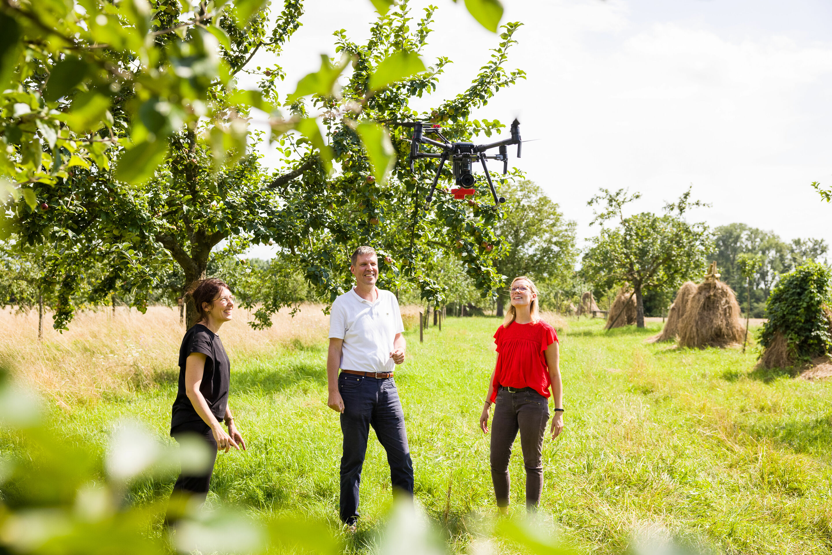
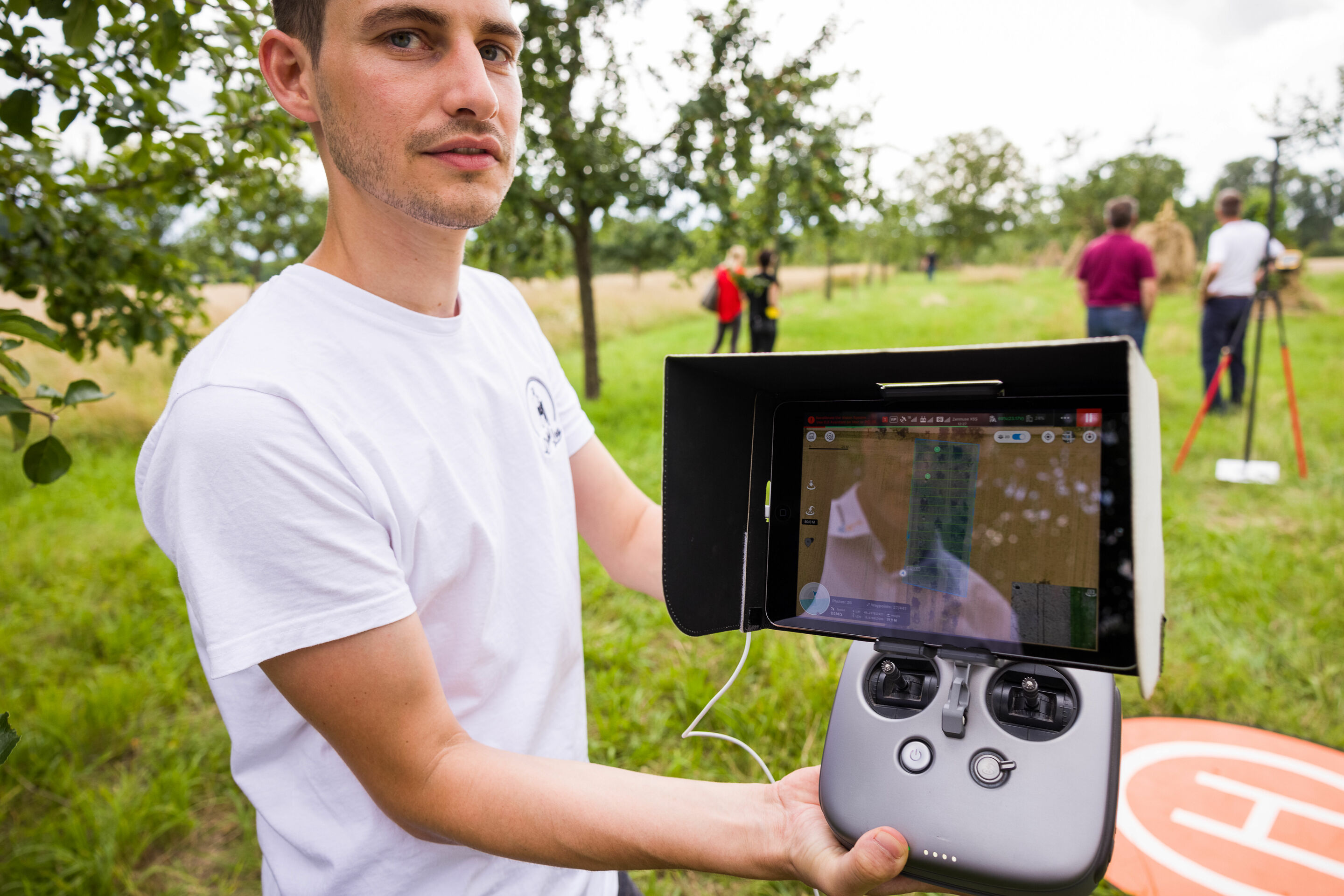
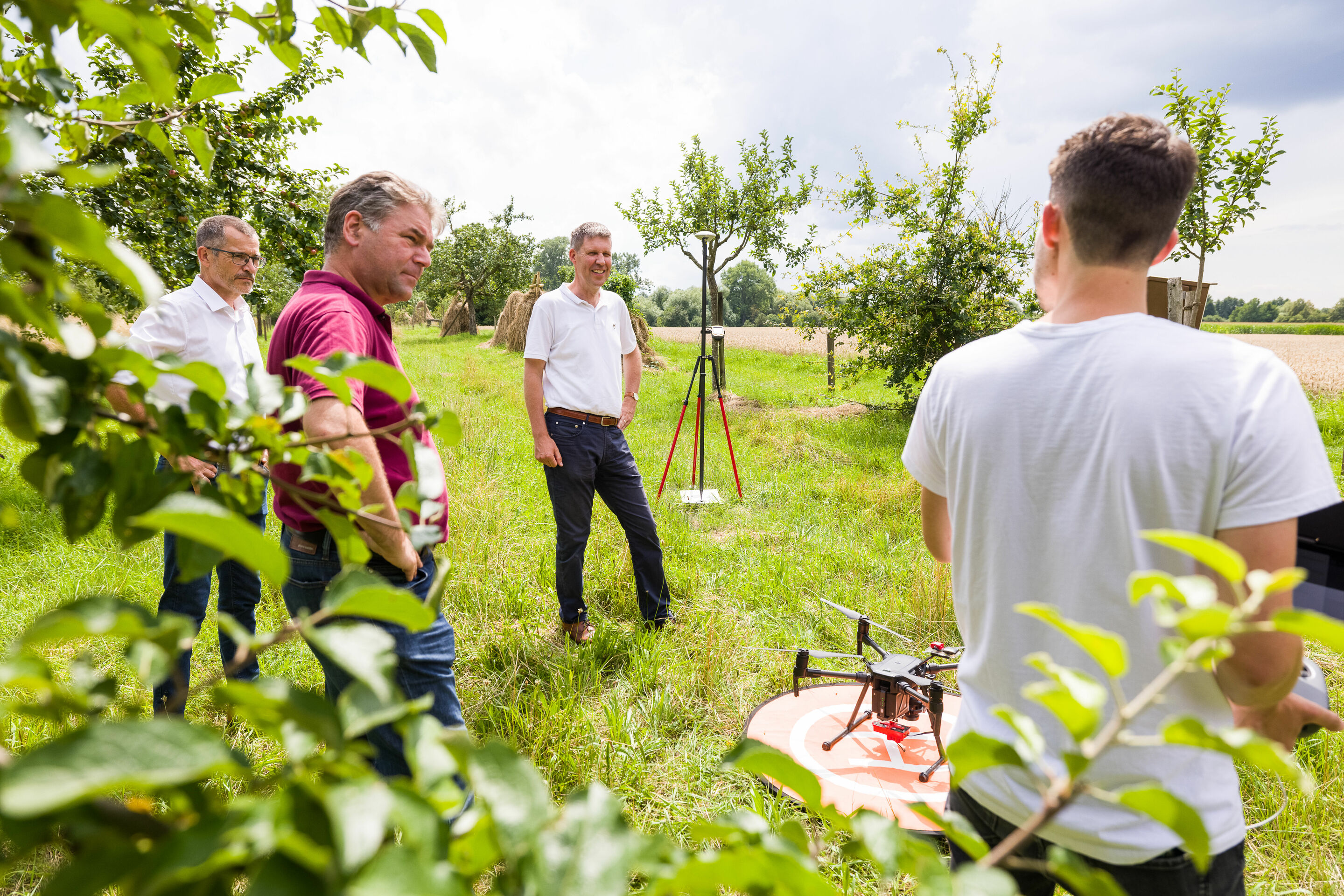
A Heidelberg University of Education research drone circles again and again over the orchard meadows of the Bad-Schönborn community: Within the framework of the research project for “recording and assessing the meadow orchard and providing sponsorship,” which is supported by the Audi Environmental Foundation, the participants have been able to make significant progress in automated, digital classification and assessment of fruit tree stocks: The accuracy of the software in recognizing the tree species has been increased to around 90 percent and information about the vitality of the stock has been derived. The next step is to record and analyze the entire orchard area. This should start in autumn. The aim is to continuously improve the control of the software tools so that they can determine tree types even more accurately and determine the state of health of the trees. Based on these results, tailor-made measures for the protection and maintenance of the stocks are to be derived.
This joint project between the Audi Environmental Foundation and the Geography Department at Heidelberg University of Education, the Karlsruhe District Authority, and the Bad Schönborn Working Group on Habitat, Nature, and the Environment (AHNU) has scored additional core successes with the completion of the test area flights and the high hit rates. The use of modern geotechnology is intended to indicate the type, vitality, and condition of the local fruit trees and therefore contribute to maintaining that stock and simplify its maintenance significantly. In the long term, this also helps to secure the habitat of native animals and insects. In the next step, the quality of the data is evaluated in detail. Through machine learning, the software and therefore the precision of the results will get even better.
To that end, the geographers have used the aerial photos to develop a model for automatically recognizing the vitality and condition of the trees in the meadow. Additionally, infrared photos from a multispectral camera, from which surface models of the landscape are derived, help determine the condition of individual fruit trees and differentiate between them. Together with the overlapping photos from the drone camera, the recordings make the condition of the meadow orchard visible in the form of a 3-D model.
Additionally, our partners have developed educational concepts for different primary school grade levels to convey the high value of a meadow orchard. The objective is to make schools, spa guests, and the local population aware of this type of cultivated landscape and call their attention to protecting the habitat for local species diversity. Rüdiger Recknagel, Director of the Audi Environmental Foundation, supports this: “Our foundation works to connect the use of modern technology with ideas about environmental protection. This project combines scientific expertise with educational work, environmental education, and individual engagement and thereby creates sustainable awareness of habitat preservation and species diversity.”
Prof. Alexander Siegmund, who heads the project team at the Heidelberg University of Education, adds, “For us, the meadow orchard is a model project that can ideally connect the potential behind the use of modern drone and geo-technology with preservation and conveyance of this unique cultivated landscape. As a UNESCO professorial chair for Earth observation and geocommunication, we have a great deal of experience in environmental research and sustainability communication, which we can bring to bear here in the best possible way.”
As the basis for long-term meadow orchard monitoring, students from the Baden-Wuerttemberg Cooperative State University are developing an initial test version of the online mapping service in the form of a web GIS, which is intended to make the results of the drone flights accessibly and interactively usable for anyone who is interested. In the future, it should be possible to use this database to, among other things, provide tree sponsorships by making contact and communication between owners and sponsors simpler.